
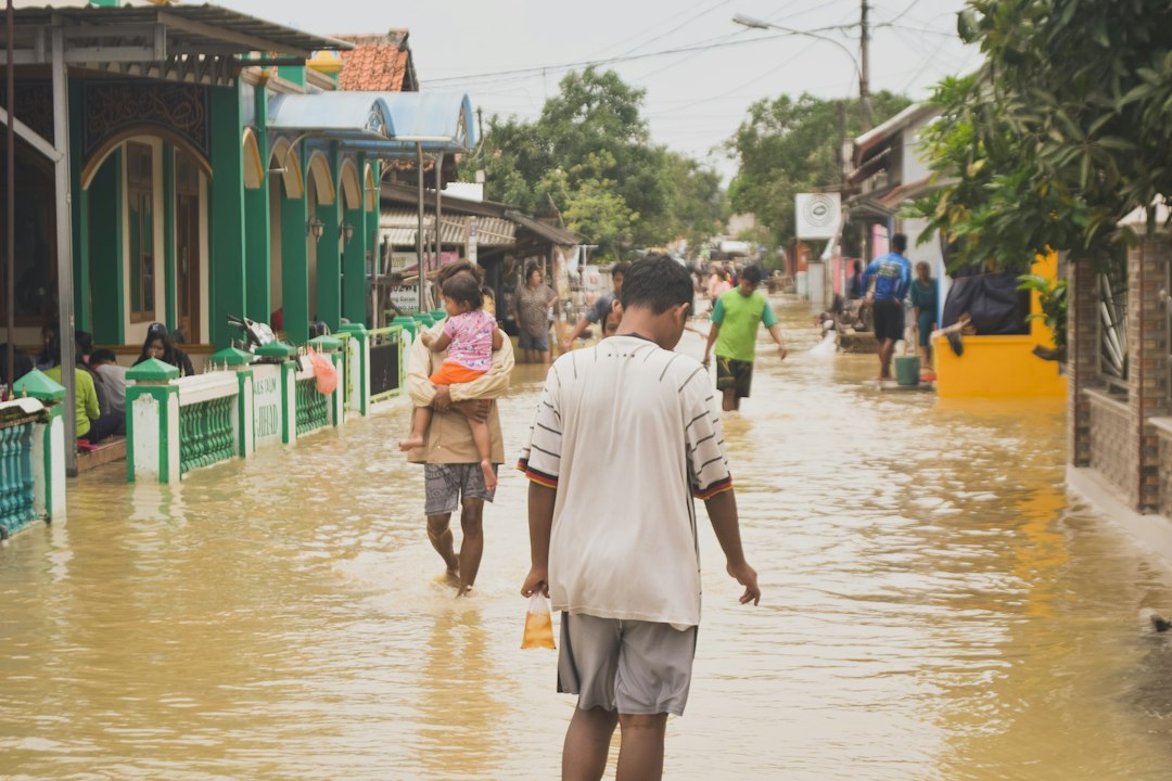
Heavy rains flooded towns along the Georgia-Tennessee border, prompting emergency crews to carry out dozens of rescues, according to reporting carried by Google News — World.
Details from the scene remain limited, but the shape of the event is one North Georgia has come to know well: a slow-moving band of rainfall parked over steep terrain, creeks that rise faster than anyone can sandbag, and first responders pulling people out of cars and homes. In the ridges and hollows that straddle the state line — Dade, Walker, Catoosa and Fannin counties on the Georgia side — water has nowhere to spread. It channels. What falls on a mountainside in Tennessee arrives in a Georgia town in minutes.
For Atlanta readers two hours south, that is not someone else's weather. It is the upstream half of our own water story.
**Why the same storms hit harder now**
The physics are not in dispute. A warmer atmosphere holds more water vapor, and when it rains, it rains harder. That is the single most consistent climate signal across the Southeast: not necessarily more storms, but heavier ones, dropping more water in less time. Rainfall that once qualified as a rare event now shows up in the forecast with uncomfortable regularity.
The infrastructure underneath, meanwhile, was sized for the old numbers. Culverts, storm drains, bridge clearances and floodplain maps across Georgia were engineered against historical rainfall records — records that newer storms keep overrunning. When a system is built for a 1970s rainstorm and handed a 2020s one, the failure is not mysterious. It is arithmetic.
**Atlanta's version of the same problem**
Metro Atlanta's flood exposure looks different from a mountain town's, but it comes from the same source. Decades of growth replaced absorbent ground with roofs, parking lots and roadway, and water that once soaked in now runs off fast and concentrated into creeks like Peachtree, Nancy, Proctor and South River. Residents along those corridors already know the pattern: an afternoon of hard rain, then water in the street, then water in the basement.
The neighborhoods that flood are rarely random. In Atlanta, the most repeatedly inundated blocks tend to be the ones with the least green space, the oldest drainage, and the least political capital to get it replaced — which makes stormwater a civil rights question as much as an engineering one.
**What a serious response looks like**
Pulling dozens of people out of floodwater is a success story about emergency crews and a failure story about everything upstream of them. Reducing the number of rescues required means work that is less dramatic than a swift-water boat and considerably more durable: updating rainfall and floodplain assumptions to reflect current conditions rather than historical ones, sizing replacement culverts and drains for the storms now arriving, buying out or elevating the structures that flood over and over, and restoring the floodplains, wetlands and tree canopy that store water for free.
It also means investing in the warning systems that give a family in a valley town — or a tenant on a flood-prone Atlanta street — enough minutes to get out. Those minutes are cheap compared with a rescue.
Georgia's climate conversation is often framed around the coast, where sea level rise and storm surge threaten Savannah and the barrier islands, or around agriculture, where heat and drought squeeze farm margins. Flooding deserves equal billing. It arrives inland, it arrives fast, and as the state line showed this week, it does not wait for a hurricane to make itself felt.
*Originally reported by Google News — World.*